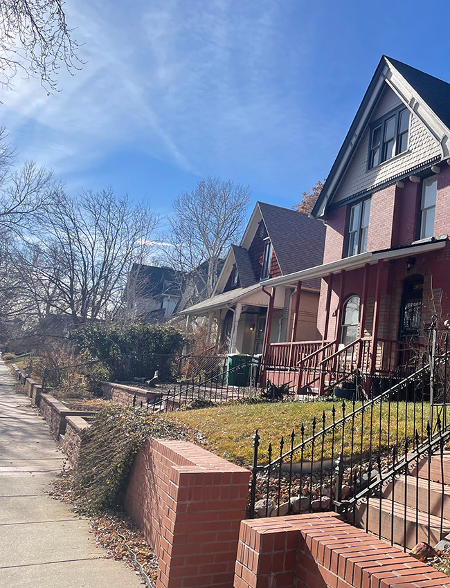
City Park West
City Park West is bordered by Colfax Ave. to the south, Downing st to the west, 23rd Ave to the north, and York St to the east.
 City Park West Demographics
5,426
Total Population
Denver Population: 706,799
35
Median Resident Age
Denver Median Resident Age: 35.5
$55,553
Median Income Per Resident
Denver Median Income Per Resident: $53,437
$68,627
Median Income Per Household
Denver Median Income Per Household: $85,721
$931
Median Rent
Denver Median Rent: $1,143
$644,680
Median Home Value
Denver Median Home Value: $513,621
27.5%
% homes owner occupied (vs. renter)
Denver % of homes owner occupied (vs. renter): 46.4%
89%
% homes occupied (vs. vacant)
Denver % home occupied (vs. vacant): 94%
 Public Safety
Denver Police District 6
Address: 1566 N Washington St.
Phone:720-913-2800
Community Resource Officers
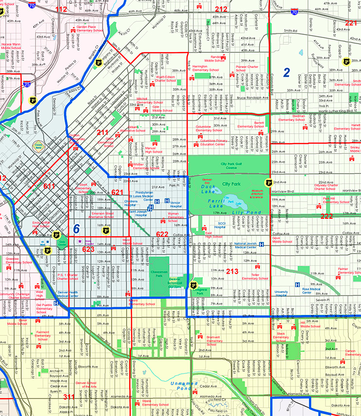
Denver Police Districts Map
The map above shows the outline of Police Districts 2, 3 & 6 within the boundaries of Denver District 10.
City Park West – Year Home Was Built
Data for Year Home Was Built-City Park West Compared to Denver
| Year Home Was Built | City Park West | Denver |
|---|---|---|
| Before 1939 | 39% | 18% |
| 1940 – 1949 | 5% | 6% |
| 1950 – 1959 | 4% | 14% |
| 1060 – 1969 | 10% | 11% |
| 1970 – 1979 | 7% | 13% |
| 1980 – 1989 | 6% | 8% |
| 1990 – 1999 | 6% | 7% |
| 2000 – 2009 | 13% | 11% |
| 2010 – 2013 | 9% | 13% |
| After 2013 | 2% | 0.3% |
City Park West – Resident Ethnicity
Data for Resident Ethnicity-City Park West Compared to Denver
| Resident Ethnicity | City Park West | Denver |
|---|---|---|
| White | 64.8% | 57.5% |
| Hispanic | 14.6% | 27.4% |
| Black | 14.8% | 7.5% |
| Asian | 2.0% | 3.1% |
| Other | 0% | 0.3% |
| Two or more | 3.5% | 3.7% |
City Park West – Resident Education Level
Data for Resident Education Level-City Park West Compared to Denver
| Resident Education Level | City Park West | Denver |
|---|---|---|
| Bachelor or higher | 62% | 53% |
| Some college | 17% | 22% |
| HS grad or Equiv | 16% | 16% |
| Less than HS | 5% | 10% |
City Park West – Resident Age
Data for Resident Age-City Park West Compared to Denver
| Resident Age | City Park West | Denver |
|---|---|---|
| 0 to 9 | 11% | 11% |
| 10 – 19 | 2% | 10% |
| 20 – 29 | 23% | 18% |
| 30 – 39 | 25% | 21% |
| 40 – 49 | 13% | 14% |
| 50 – 59 | 9% | 10% |
| 60 – 69 | 10% | 9% |
| 70 – 79 | 5% | 5% |
| 80+ | 2% | 3% |
 City Park West History
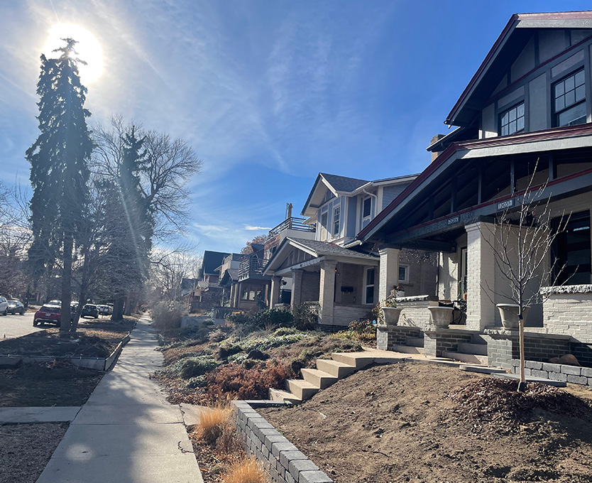
As with many other neighborhoods, it was surveyed and platted speculatively, well before ground was broken for construction, with the western portion of the neighborhood platted earliest in the 1870s, and later plats proceeding south and east through the 1880s. In the 1880s, residential development in City Park West increased dramatically as Denverites chose to escape the denser urban environments for the more open lots of the streetcar suburbs. The reciprocal relationship between the streetcar lines and residential and commercial developers resulted in City Park West becoming a key growth area in the city in the 1880s and 1890s. This period saw the streetcar routes become lined with the one-and two-part commercial block buildings that housed the small markets, shops and eateries that were important everyday destinations along the streetcar lines. The Foursquare in particular took hold in City Park West and other adjacent neighborhoods. In short order, this simple two-story box form with its center dormer and simple style elements would be known as the “Denver Square,” but only in Denver.
One important piece of the history of City Park West concerns the availability of housing to nonwhite residents of Denver. Race restrictions in real estate transactions were common in the 1920s as a way of maintaining white exclusivity in the neighborhood, but “custom and pressure” had long precluded potential African-American homeowners from purchasing property east of Downing Street, confining African-American residents largely to the Five Points area.
But in the 1920s, despite the fact that the Ku Klux Klan was working actively to promote their white supremacist agenda in Denver and even Mayor Benjamin Stapleton had declared his allegiance to the Klan, individual homebuyers and sellers in City Park West defied restrictive covenants and some African-American families bought homes there. They risked much to do it: a black fireman who purchased a home just north of City Park West in the Whittier neighborhood found a mob of 250 whites at his door demanding that he and his family move. They did. In 1921, a bomb exploded on the lawn of Walter Chapman, a black postal clerk who rented a house on Gilpin Street in City Park West. City Park West’s proximity to other neighborhoods that were predominately African American made it one of the areas in Denver impacted by a practice known as “redlining,” in which mortgage lenders, based on standards created by the Federal Housing Administration (FHA), codified neighborhoods by race and ethnicity and refused home loans in areas they deemed less desirable and therefore less stable. In City Park West, African-American residents were restricted from moving east of City Park, and the neighborhood’s population peaked in the 1950s, as it and adjacent neighborhoods became dangerously overcrowded. In the 1960s and 1970s, median income and the number of owner-occupied properties in City Park West was far below the city average. Yet unit density(i.e., the number of housing units contained in an area) was much higher than the city average, and the neighborhood’s population was much more transient than other parts of the city. The area was found by a federal study to be “blighted.”
Beginning in 1977, City Park West and the adjacent North Capitol Hill, later considered together as the “Uptown” area, were the subject of intensive study by the City and County of Denver. This resulted in the development of a 1979 neighborhood plan that sought to emphasize and foster much of what the residents considered to be desirable and improve that which they found undesirable. The neighborhood organizations worked with the city to identify strategies that would strengthen, protect, and enliven City Park West and North Capitol Hill. The residents rejected the label, “blighted” and noted that in the two years prior the deterioration of Uptown had begun to reverse. They credited this reversal, at least in part, to a renewed appreciation on the part of younger people and longtime residents for the historic quality of the neighborhoods’ architecture, specifically pointing to a 1978 study in which the city’s Landmark Preservation Commission found 108 buildings in City Park to be architecturally or historically significant. As important, the study called out the diverse ethnic and racial make-up of the two neighborhoods and clearly stated that the residents valued this mix and wanted to retain it. Strategies for revitalization addressed such areas of life as employment, crime reduction, transportation, parks and recreation, education, and yes, even historic preservation. Although much of the plan was not immediately implemented and some of it never was, its effect and the efforts of the neighborhood residents can be clearly seen today as City Park West is now considered to be one of the most attractive and lively of Denver’s neighborhoods.
Read more about City Park West History
The Territorial Session Law of 1864 made the area west of what is now High Street part of Denver, and subsequent legislative acts in 1874 and 1883 completed the addition of the land that is now contained in City Park West to the city.
